New satellite images reveal the extensive devastation caused by the Palisades and Eaton fires in Los Angeles County.
The impact has been devastating: multi-million-dollar homes reduced to rubble, widespread power outages plunging neighborhoods into darkness, leaving at least five people dead and forcing 130,000 residents to evacuate, according to the Associated Press.
Why It Matters
Questions remain as to how the fires were ignited. The Palisades Fire, which began on Tuesday, quickly escalated due to severe drought conditions and powerful Santa Ana winds, with gusts reaching up to 100 mph. The National Weather Service described the resulting situation as “life-threatening.”
Later that day, two additional fires broke out: the Eaton Fire in Altadena and the Hurst Fire in Sylmar.
The Eaton Fire, driven by dry vegetation and relentless winds, has burned over 10,600 acres, prompting widespread evacuations and causing extensive property damage.
Meanwhile, the Hurst Fire has consumed 855 acres and is just 10 percent contained, according to CAL FIRE.
The fires are already estimated to be the most costly in Los Angeles history.
What To Know
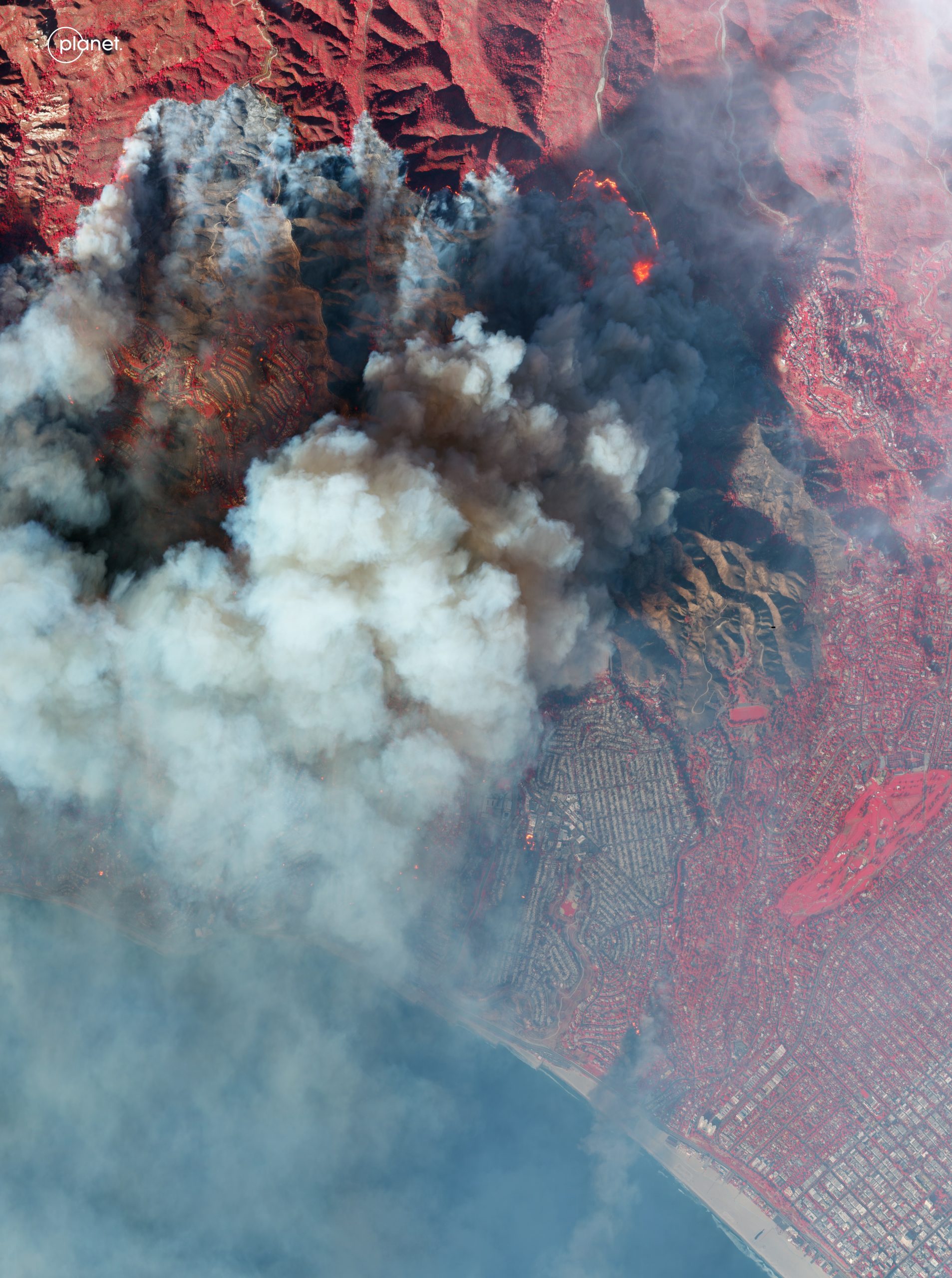
Images provided to Newsweek by Planet Labs reveal the scale and intensity of the Southern California wildfires as they intensified on Wednesday.
As of January 9, the Palisades Fire remains uncontained, with over 1,000 structures destroyed, making it the single most destructive wildfire ever seen in L.A.

The imagery shows a vast swath of scorched earth and smoldering terrain in Los Angeles County, with dense blackened vegetation marking the path of the Palisades Fire as it burns westward, toward the Pacific Ocean.
Planet Labs
The satellite imagery captures the affected zones and their proximity to the affluent residential neighborhoods that ring Los Angeles.

Planet Labs
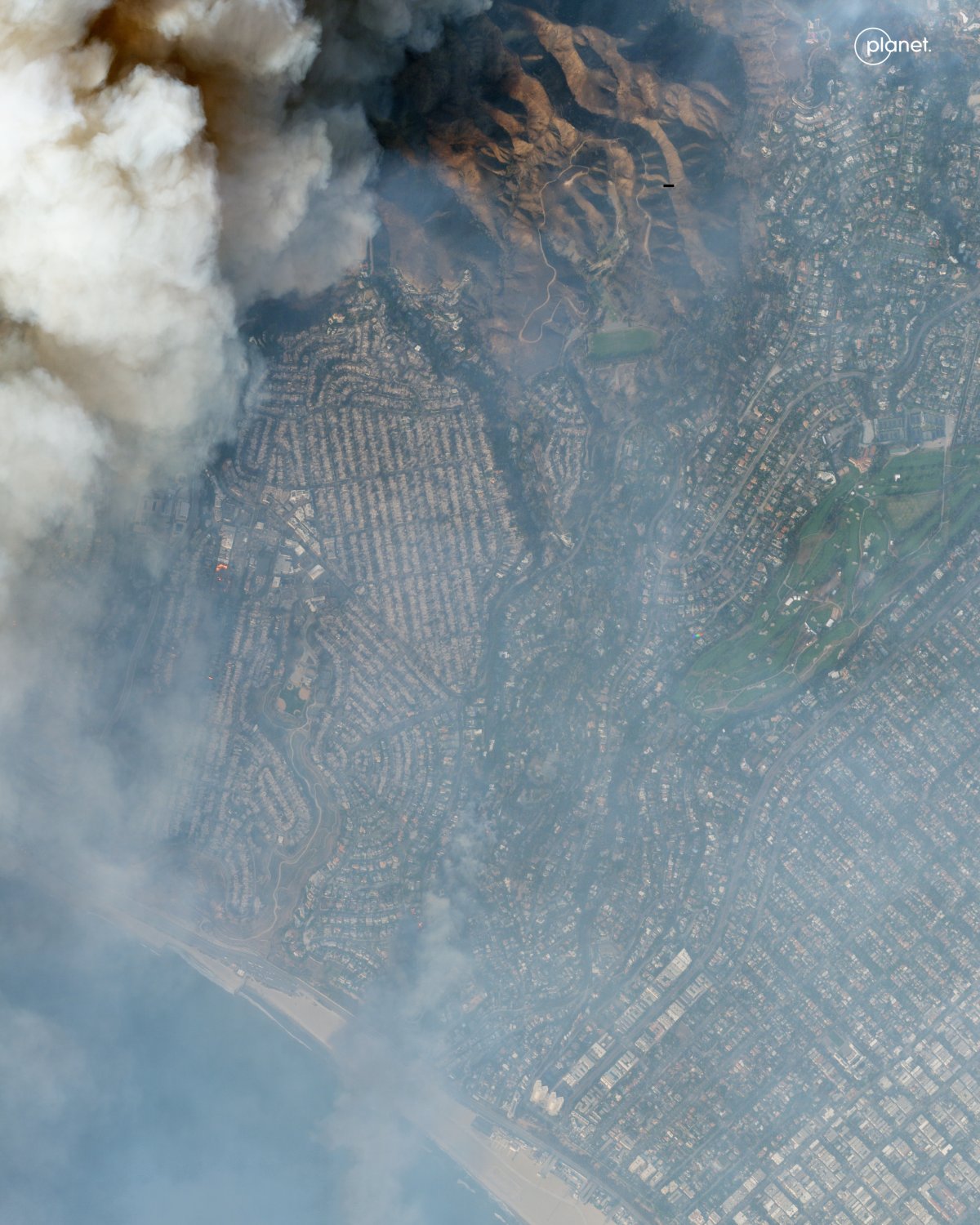
Similarly, the Eaton Fire erupted in the Altadena area, fueled by dry vegetation and strong winds, leading to widespread evacuations and significant property damage.
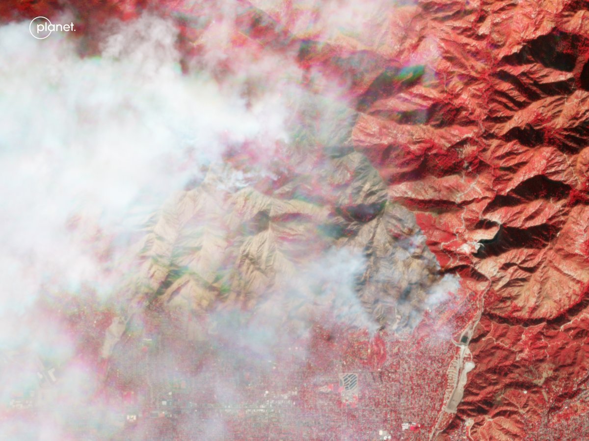
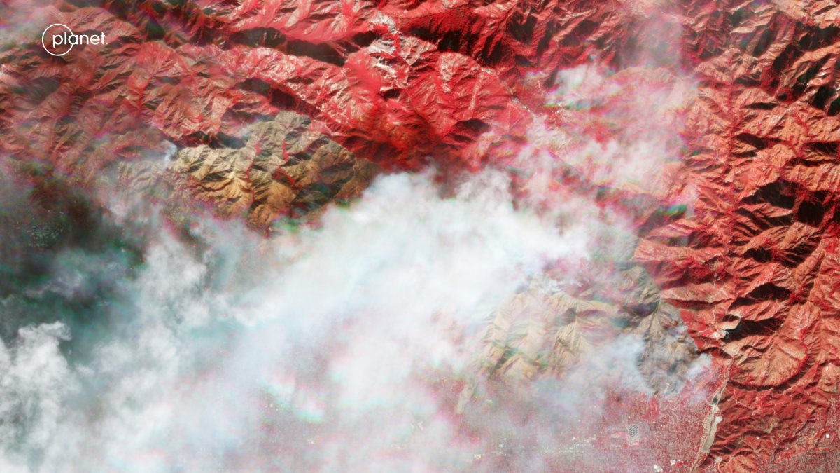
In the Eaton Fire images, the false-color satellite imagery below highlights the active fire zones and surrounding terrain. Areas of vegetation are displayed in shades of red due to the infrared spectrum used, making it easier to identify burn scars and unburned areas.
Planet Labs
Smoke from the fire is visible, spreading over the landscape, and the image shows the proximity of the fire to urban areas of Altadena.
Planet Labs
Are There Other Fires?
On Wednesday afternoon two more fires broke out. The Sunset Fire, which was sparked in the Hollywood Hills, has since spread to 60 acres, according to the Los Angeles Fire Department. The famous strip in West Hollywood, Sunset Boulevard, is in ruins from the flames, the Los Angeles Times reported.
The second fire that started on Wednesday, the Lidia Fire, is in the mountainous Acton area north of Los Angeles and covered almost 350 acres. Authorities say it has been 40 percent contained.
What People Are Saying
CAL FIRE’s most recent update for the Palisades fire: “Extreme fire behavior, including short and long-range spotting, continues to challenge firefighting efforts for the Palisades Fire. Winds gusts up to 60 MPH are expected to continue through Thursday, potentially aiding in further fire activity and suppression efforts.”
California Governor Gavin Newsom wrote on X (formerly Twitter): “To the heroes, firefighters, and first responders battling these fires in Los Angeles: Your sacrifice and determination inspire the entire state. California is deeply grateful for your dedication and service.”
Dr. Puneet Gupta, the assistant medical director for the Los Angeles County Fire Department, warned to the AP: “We have a number of hospitals threatened, and if they have to be evacuated, it could become a crisis.”
What Happens Next
According to Newsom, as of Wednesday night, more than 7,500 personnel had been deployed to tackle the spread of the fire, as well as 1,162 fire engines, 23 water tenders, 31 helicopters, 53 dozers, and six air tanker.
The Santa Ana wind event that is making the fires so difficult to contain is expected to continue at least through Friday. The National Weather Service has issued a Red Flag Warning for the Los Angeles area, indicating critical fire weather conditions due to strong winds and low humidity. This warning remains in effect until 6:00 PM PST on Friday.