Some parts of northeastern Texas could see a month’s worth of rain in only two or three days this week as persistent thunderstorms dump heavy precipitation across the area.
Why It Matters
Although Texas is no stranger to severe thunderstorms during the summer months, the ongoing storms are particularly laden with moisture and will dump more precipitation than is typical of this time of year.
Much of the rain will fall in areas that are no longer in drought because of similar storms earlier in the spring. The largest concern among weather experts is dangerous flooding in the hardest-hit areas, AccuWeather senior meteorologist Tom Kines told Newsweek.

Suzanne Schroeder/Getty
What To Know
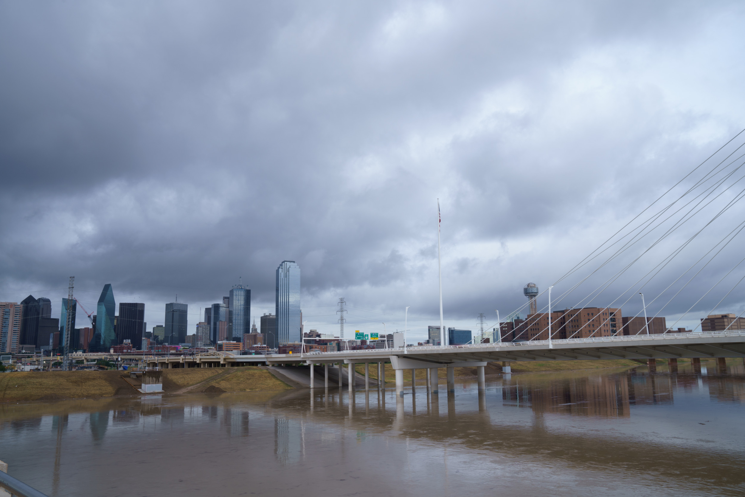
Forecasts say that Dallas and much of northeastern Texas are set to experience rainfall totals far above the historical June average, with some localities potentially seeing their entire expected June rainfall in only two days.
Heavy downpours are already affecting the region and will continue to do so until Friday, with meteorologists at AccuWeather warning that localized accumulations could reach between 4 and 8 inches, surpassing the typical Dallas June rainfall of 3.7 inches.
Other cities anticipating heavy rain include Austin and Waco. Slightly lower amounts are more widespread, including in Corpus Christi, San Antonio and Houston.
The risk of flash flooding prompted the National Weather Service (NWS) to issue a Flood Watch for the Dallas-Fort Worth Metroplex, extending through Thursday evening. Meteorologists explained that while most of the region would see at least one to four inches of precipitation, some locations could face even heavier and more sustained downpours, especially during the midweek morning commute and into Thursday, according to FOX 4 News.
AccuWeather meteorologists observed that although most of central and eastern Texas had recently received enough rain to reverse drought conditions, the anticipated rapid and voluminous rainfall posed renewed challenges, overwhelming already saturated soils and increasing the chance of dangerous, fast-moving floods.
Area forecasts called for periodic storms moving across the Interstate 10 and 20 corridors, with particular attention to the I-35 corridor running through Dallas. The combination of Gulf moisture and a slow-moving upper-level storm system from northern Mexico contributed to a highly unstable atmosphere, primed for intense thunderstorms and extended periods of heavy rain, AccuWeather reported.
What People Are Saying
AccuWeather senior meteorologist Tom Kines told Newsweek: “The normal rainfall for the month of June is between 4.5 and 5 inches [for northeast Texas]. It’s not out of the question that somebody in that area picks up a month’s worth of rain over the course of two to three days.
“If you are getting a month’s worth of rain in two or three days, you’re going to have some flooding problems to deal with.”
Flash flood warning issued by the NWS office in Fort Worth: “Life threatening flash flooding of creeks and streams, urban areas, highways, streets and underpasses. Turn around, don’t drown when encountering flooded roads. Most flood deaths occur in vehicles.”
What Happens Next
Rain could continue to fall east of Dallas through Friday, Kines said. Many flood watches remain in place through Thursday night, with the most severe flash flood warnings expiring on Wednesday night.