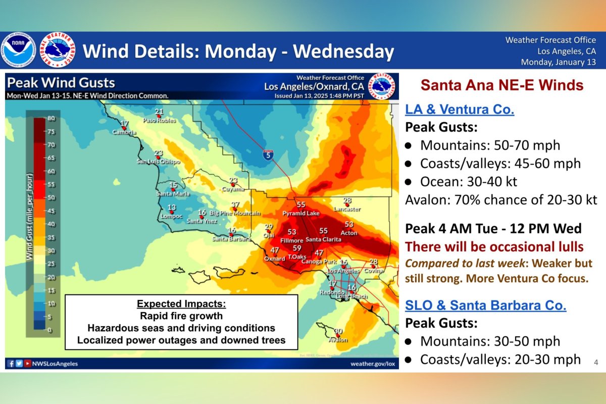
A wind forecast map from the National Weather Service has highlighted areas around Los Angeles expected to see the strongest gusts from northeast-east Santa Ana winds through Wednesday.
Why It Matters
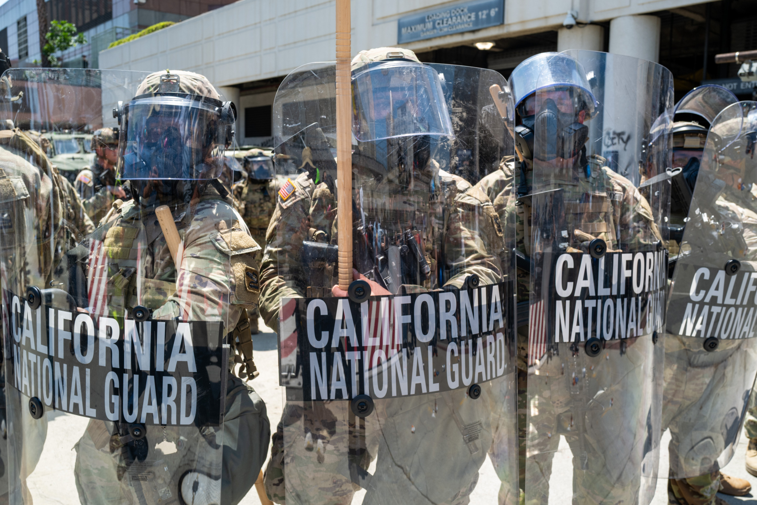
Firefighters battled numerous blazes across the area through the past week. At least 24 people have died and thousands of homes have been destroyed.
Strong winds pose a danger of spreading the ongoing fires or fueling new ones.
What to Know
According to the NWS map, the areas affected most include Santa Clarita, Pyramid Lake, Acton, Fillmore, Thousand Oaks, Oxnard and Canoga Park.
NWS
These areas could see gusts ranging from 45-70 mph, the map suggested.
For Los Angeles and Ventura Counties, peak gusts of 50-70 mph in the mountains were expected. For coasts and valleys, gusts of 45-60 mph were predicted.
A peak was anticipated from 4 a.m. Tuesday to 12 p.m. Wednesday.
The NWS said that compared to last week the gusts would be “weaker,” but “still strong.”
San Luis Obispo and Santa Barbara Counties could see peak gusts in the mountains of 20-50 mph, and in the coasts and valleys 20-30 mph.
The service said to expect rapid fire growth, hazardous driving conditions and seas, as well as localized power outages and downed trees.
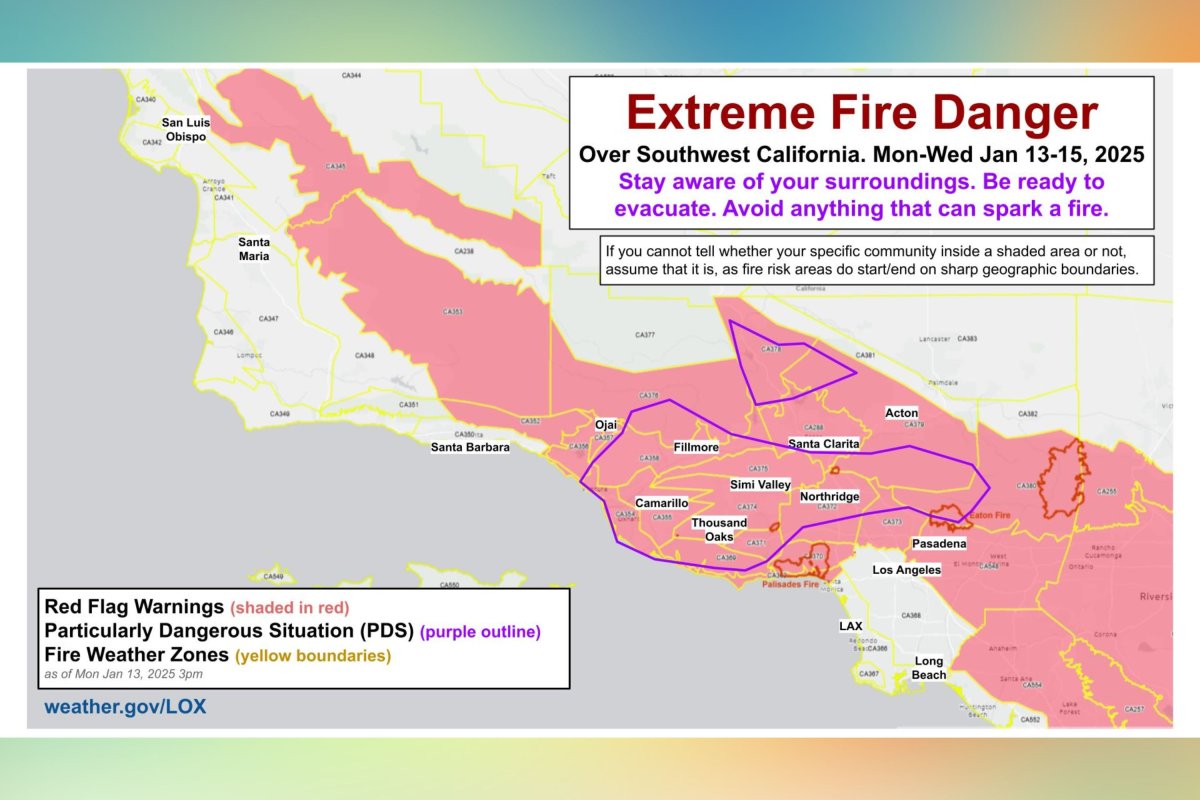
Red flag warnings—meaning there is an increased risk of fire danger due to a combination of warm temperatures, very low humidity and stronger winds—were also in effect across Southwest California.
NWS
The NWS said that areas with a particularly dangerous situation included Camarillo, Fillmore, Thousand Oaks, Simi Valley and Northridge.
What People Are Saying
LA County Fire Chief Anthony Marrone said at a press conference Monday: “They said 70-mile-an-hour winds. It’s going to be very difficult to contain that fire.
“That’s why we ask all residents in a brush prone area to be prepared to evacuate if you get the evacuation order and start those preparations before the evacuation warning comes.”
National Weather Service Los Angeles said on X: “Please note: If you cannot tell whether your specific community inside a Red Flag or PDS shaded area or not, assume that it is. The fire risk areas do not start/end as sharply as our geographic boundaries do. Stay safe neighbors.”
What Happens Next
At the time this article was written, the latest red flag warnings from the NWS were in effect until 6 p.m. Wednesday.
The NWS issues regular updates on its website.
Do you have a story we should be covering? Do you have any questions about this article? Contact [email protected]